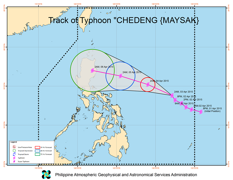
Chedeng, still packing sustained top near-center winds of 165 kilometers per hour as of Friday morning, could make landfall Sunday evening or early Monday morning in Isabela just south of the town of Palanan, PAGASA said in its latest bulletin.
Cyclones with maximum sustained winds of over 118 kph are classified as typhoons by PAGASA.

State weather forecasters warned that the seas east of the Luzon mainland will be rough as Chedeng moves closer, with waves as big as 4.5 meters or almost 15 feet and would be dangerous to sea vessels.
Fishing boats and small seacraft were advised not to venture out to sea, while larger vessels were alerted against big waves.
The rough seas can affect coastal areas as far down south along Southern Luzon and further down to the Eastern Visayas.
PAGASA’s forecast for the whole country is partly cloudy to cloudy skies with isolated rain showers or thunderstorms.
![]()