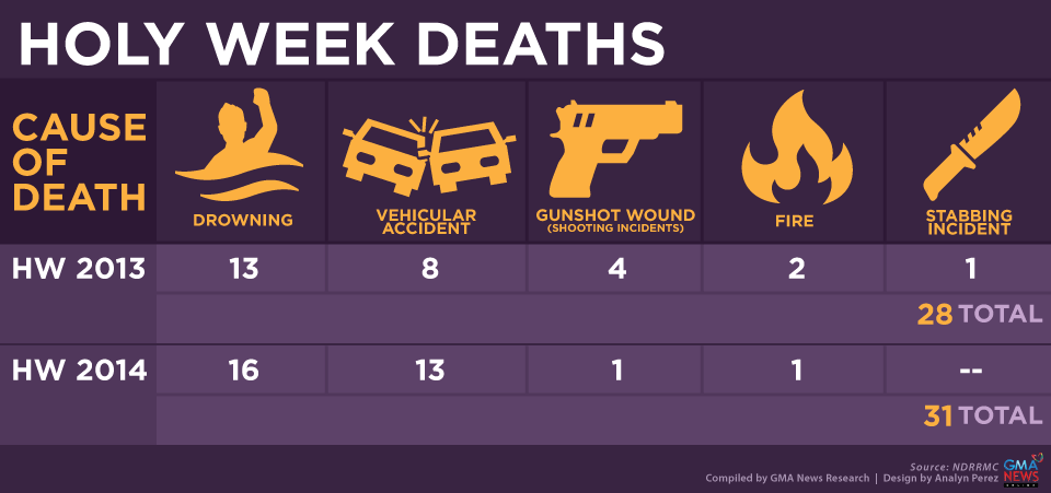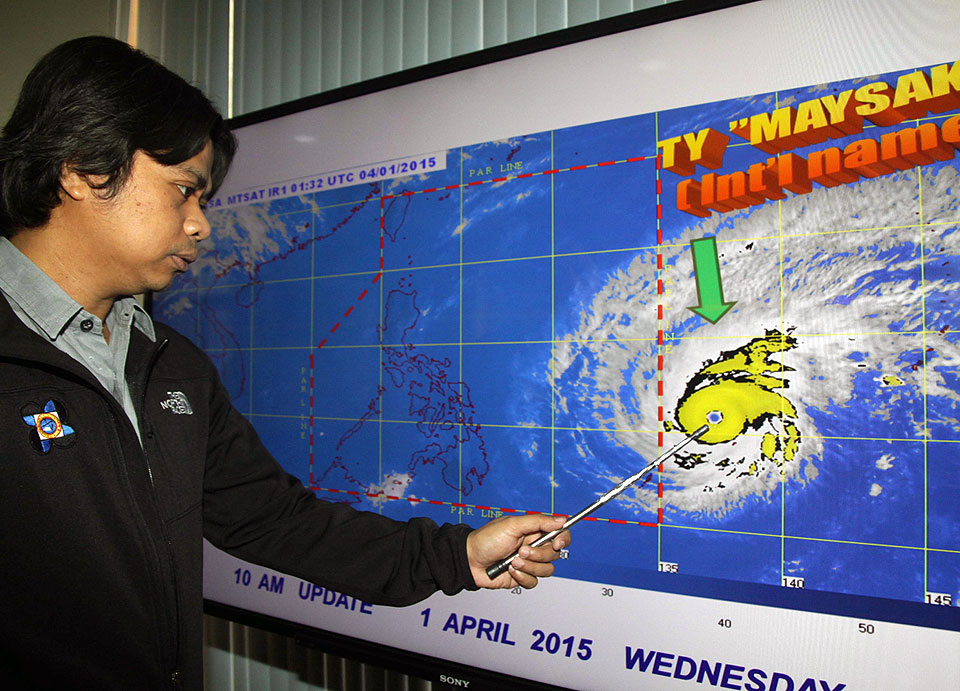
Maysak approaches PAR. A PAGASA weather forecaster shows a satellite image of Super Typhoon Maysak as it approaches the Philippine Area of Responsibility (PAR) as of 11:00 am on Wednesday, April 1. It will be named Chedeng after it crosses the boundary, and will affect the Philippines come Easter weekend. GMA News Typhoon Maysak finally entered the Philippine Area of Responsibility (PAR) before midnight Wednesday and was locally codenamed Chedeng. State weather agency PAGASA’s 11:30 p.m. advisory said Chedeng will bring heavy to at times intense rainfall within its 150- to 200-km radius. PAGASA said it will raise Public Storm Warning Signal 1 over Bicol and Samar in 18 hours, and “sea travel over these areas will be possibly suspended.” Also, it said Chedeng may make landfall over the eastern coast of Samar, Quezon or Isabela by late Saturday to early Sunday. PAGASA alerted the public against possible flash floods over low-lying areas and landslides along mountain slopes particularly over Aurora-Quezon area. It also warned of possible storm surges and sea surface waves of up to four meters, over the eastern coast of Samar, Bicol and Aurora-Quezon. PAGASA advised fisherfolk not to venture out over the eastern seaboard of Bicol region and of Visayas. As of 11 p.m., PAGASA said Chedeng was estimated at 1,015 km east-northeast of Guiuan, Eastern Samar or 1,040 km east of Borongan, Eastern Samar. It packed maximum sustained winds of 180 kph near the center and gustiness of up to 215 kph, and is forecast Read More …