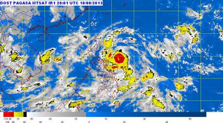
Typhoon Labuyo packs 140 to 170 kph winds, Signal No. 3 raised. PAGASA raised Public Storm Warning Signal No. 3 over Catanduanes as Typhoon Labuyo moved closer to Luzon Sunday morning and is expected to make landfall in Aurora on Monday. PAGASA
At least five areas were placed under Storm Signal No. 3 as Typhoon Labuyo (Utor) moved closer to Aurora province Sunday morning, state weather forecasters said.
PAGASA said Labuyo was estimated at 160 km northeast of Virac, Catanduanes, or 270 km east-northeast of Daet, Camarines Norte as of 10 a.m.
In its 11 a.m. advisory, PAGASA said Labuyo packed maximum winds of 150 kph near the center and gustiness of 185 kph.
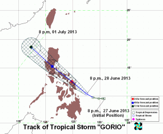
Labuyo was moving west-northwest at 19 kph and is expected to be in the vicinity of Casiguran, Aurora, Monday morning.
By Tuesday morning it is expected to be 270 km northwest of Sinait, Ilocos Norte, or in the northwest boundary of the Philippine area of responsibility.
Storm signals
Under Signal No. 3 are:
Catanduanes
Camarines provinces
Northern Quezon including Polilio Island
Aurora
Isabela
Under Signal No. 2 are:
Albay
Sorsogon
Rizal
rest of Quezon
Laguna
Bulacan
Nueva Ecija
Quirino
Nueva Vizcaya
Benguet
Ifugao
Mountain Province
Kalinga
Cagayan
Under Signal No. 1 are:
Calayan Islands
Babuyan Islands
Ilocos Norte
Ilocos Sur
Apayao
Abra
La Union
Pangasinan
Tarlac
Zambales
Pampanga
Bataan
Cavite
Batangas
Marinduque
Burias
Ticao Islands
Metro Manila
Northern Samar
Rainfall
PAGASA said Labuyo may bring rainfall of 7.5 to 25 mm per hour (heavy to intense) within its 600-km diameter.
It advised residents in low-lying and mountainous areas under storm signals to be alert against possible flash floods and landslides.
Also, it warned residents in coastal areas under signals 2 and 3 to be alert against storm surges.
PAGASA also said Labuyo will enhance the southwest monsoon which will bring moderate to occasionally heavy rain over the rest of Southern Luzon, Visayas and Mindanao.
“Sea travel is risky over the seaboards of Southern Luzon, Visayas and Mindanao,” it said. — LBG, GMA News
![]()
