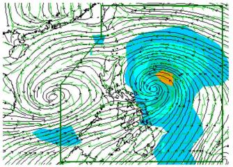
Typhoon Labuyo from the east, monsoon and possible LPA to the west. While Typhoon Labuyo comes from the east in the Pacific Ocean with 140 to 170 kph winds, PAGASA said the typhoon may enhance the southwest monsoon. Surface winds forecasts also show that a possible low pressure area may be forming just outside the Philippine Area of Responsibility far out to the west of Palawan. PAGASA
The National Disaster Risk Reduction and Management Council was placed on red alert Sunday morning for the possible effects of Typhoon Labuyo (Utor).
NDRRMC spokesman Maj. Rey Balido said a red alert was declared at 8 a.m., with all concerned personnel on standby.
“Nag-declare tayo ng red alert effective 8 a.m. Ang regions na naapektuhan at maapektuhan sa susunod na araw, on standby na [ang mga tauhan nila],” Balido said in an interview on dzBB radio.
He said those particularly on alert include disaster management teams in Ilocos, Cagayan Valley, Central Luzon, and Cordillera.
Also, Balido said teams from various government agencies are on alert and ready to respond to contingencies.
These include the Department of Social Welfare and Development, Armed Forces of the Philippines and Philippine National Police, he said.
Earlier Sunday, PAGASA said Labuyo intensified further and may make landfall over Aurora province on Monday.
Catanduanes province was placed under Storm Signal No. 3 while nine areas were under Signal No. 2 and 26 areas including Metro Manila under Storm Signal No. 1.
PAGASA forecaster Glaiza Escullar also warned Labuyo is likely to intensify further, as it is still at sea and can gather more strength.
“Maari pa ito lumakas dahil sa dagat pa ito,” she said in an earlier interview on dzBB radio.
Meanwhile, the Philippine Red Cross said it has alerted all chapters and volunteers “to monitor and report (the) situation in their respective areas.” — LBG, GMA News
![]()