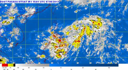
Typhoon Soulik enters PAR, codenamed Huaning. Tropical Storm Soulik, visible as a white circular cloud formation in the upper righthand portion of this image, passed into the Philippine Area of Responsibility at around 10am (PHT) on July 10. It has been given the local codename, Huaning. GMA News
The Batanes islands were placed under Storm Signal No. 1 Wednesday afternoon as Typhoon Huaning (Soulik) continued moving toward Northern Luzon, state weather forecasters said.
But PAGASA forecaster Jori Loiz said their models indicate Huaning may still not make itself felt until at least Thursday or Friday.
“Hindi tatama sa Pilipinas ang bagyong si Huaning,” Loiz said in an interview on dzBB radio.
Loiz said their models indicate Huaning may eventually head for Taiwan, though it may enhance the southwest monsoon that will bring rain over parts of the Philippines.
The typhoon is still likely to leave the Philippine area of responsibility by early Saturday, he added.
“Ang pag-ulan sa habagat maaring Friday afternoon or Saturday,” he said.
Advisory
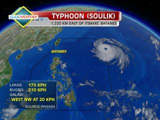
In its 5 p.m. advisory, PAGASA said Huaning was estimated at 1,150 km east of Itbayat, Batanes as of 4 p.m.
According to PAGASA, Huaning packed maximum winds of 175 kph near the center and gustiness of up to 210 kph, and was moving west-northwest at 20 kph.
By Thursday afternoon, it is expected to be 720 km northeast of Itbayat, Batanes. By Friday afternoon it is expected to be 380 km northeast of Itbayat, Batanes.
On Saturday afternoon, it is expected to be 560 km northwest of Itbayat, Batanes and outside the Philippine area of responsibility.
PAGASA also said Huaning may bring rainfall of 10 to 25 mm per hour (heavy to intense) within its 800-km diameter.
Thursday outlook
PAGASA’s 5 p.m. bulletin said Cagayan Valley, Bicol and Aurora and Quezon provinces may expect cloudy skies with light to moderate rain showers and thunderstorms.
Metro Manila and the rest of the country will be “partly cloudy to cloudy with isolated rain showers or thunderstorms,”it added.
Also, it said moderate to strong winds from the northwest will prevail over Eastern Luzon and coming from the west to southwest over Eastern Visayas.
The coastal waters along these areas will be moderate to rough, it said.
Light to moderate winds coming from the west to southwest will prevail over Mindanao and the rest of Visayas and from the northwest over the rest of the country.
The coastal waters along these areas will be slight to moderate.
Gale warning
PAGASA also warned of strong to gale force winds associated with Typhoon Huaning, which it said may affect the eastern seaboard of Northern and Central Luzon.
“Fishing boats and other small seacrafts are advised not to venture out into the sea while larger sea vessels are alerted against big waves,” it said. — BM, GMA News
![]()