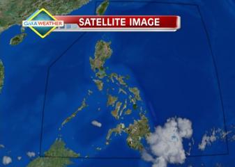
Satellite image at 7 a.m., 8 Feb 2013. Satellite image at 7 a.m., 8 Feb 2013 Weather Central
State weather forecasters on Friday afternoon started tracking a potential cyclone —a low-pressure area— off Mindanao, even as the northeast monsoon is starting to make itself felt again.
PAGASA, in its 5 p.m. bulletin, said the LPA was estimated at 500 km east of General Santos City, even as the northeast monsoon is affecting Extreme Northen Luzon.
However, PAGASA did not immediately say if the LPA has a strong chance of intensifying into a cyclone. If it becomes a cyclone, it will be codenamed Crising.
Earlier, PAGASA had said there may be “zero to one” cyclone that may enter the Philippine area of responsibility in February.
Rain over parts of PHL
For the next 24 hours, PAGASA said Batanes and Calayan islands will experience cloudy skies with light rain.
“Mindanao will have cloudy skies with light to moderate rain showers and thunderstorms,” it added.
The rest of the country will be partly cloudy with isolated rain showers or thunderstorms particularly over Bicol and Eastern Visayas.
Also, PAGASA said moderate to strong winds blowing from the northeast will prevail over Luzon, Eastern Visayas and Eastern Mindanao and the coastal waters along these areas will be moderate to rough.
Elsewhere, winds will be light to moderate coming from the northeast with slight to moderate seas. — TJD, GMA News
![]()